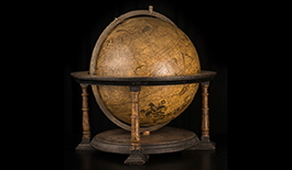
Gerardus Mercator was undoubtedly the scientist who best mastered the production of printed globes in his day, contributing numerous innovations and improvements to the process.
A pioneering series
Mercator did not invent everything. Like all scientists he drew on the discoveries of his predecessors, here and there making corrections or contributing innovations of his own […]
Rectifications of ancient geography
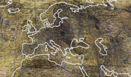
Knowledge of geography had been dominated by the Ptolemaic view since Antiquity. Yet this conception was gradually discredited by new observations […]
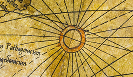
Wind roses and rhumb lines
Mercator’s printed globes were the first to display a system of wind roses that served as starting points for rhumb lines […]
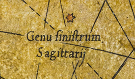
Stars and constellations to guide travellers
Mercator sought to improve his terrestrial globe by showing stars, as Gemma Frisius had done, which travellers could use as reference points […]
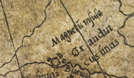
Terrestrial magnetism
Mercator’s interest in terrestrial magnetism made him a forerunner in this area. He tried to explain why the magnetic north pole did not correspond to the geographic one […]
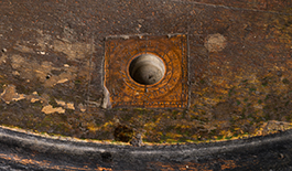
Magnetised needle
A magnetised needle was set into the stand of each of the two globes. Such needles were meant to help determine longitude […]
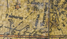
New prime meridian
The prime (or zero) meridian serves as a reference for longitudes. Mercator placed his prime meridian on Fuerteventura in the Canary Islands […]
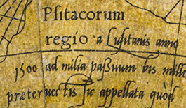
New calligraphic convention
Mercator established a new convention for printing the names of places and geographical features. By using different fonts and type sizes, he introduced the notion of an information hierarchy […]