Measuring the world

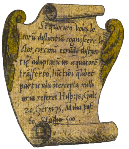
Si quorum voles locoru[m] distantia[m] cognoscere lector, circinu[m] eoru[m]de[m] distantiae adaptatu[m] in aequatore[m] transferto hic tibi q[ua]libet particula i[n]tercepta mille aria referet Hyp:18, Gal:20, Germ:15, Milia pas:60, Stadia:500.
If you, reader, wish to know the distance to certain places, measure it as adjusted by the compass placed on the equator; the distance will be 18 Spanish miles, 20 French miles, 15 German miles, 60,000 podes, 500 stadia.
This comparison of measurements suggests that it was Mercator himself who calculated the conversions, though he did not mention this anywhere. Nor did he explain the method he used to arrive at these results.
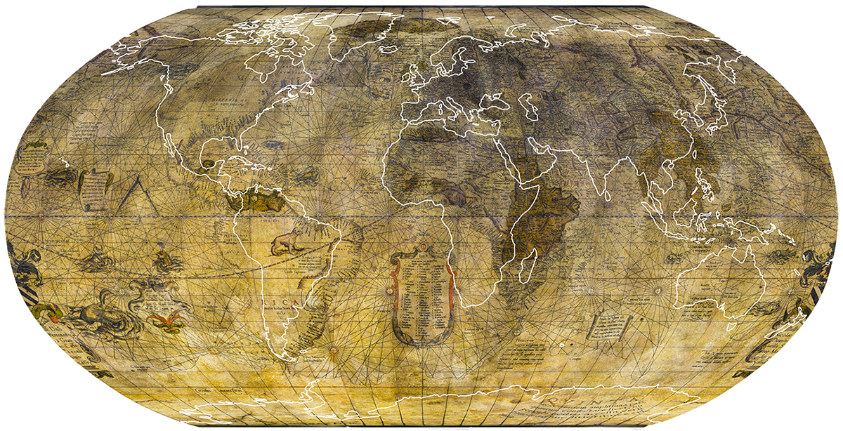
In a period marked by diverging views regarding the actual size of the Earth, Mercator estimated its circumference to be 21,600,000 podes or 180,000 stadia. The globe’s scale is roughly 1:30,000,000.
On his terrestrial globe, Mercator divided the known world into five parts: Europe, Africa, Asia, America et la Quinta, a recently discovered southern continent. New Guinea does not appear. Nor do Australia and New Zealand, which would not be discovered until the wave of expeditions to the South Seas in the 18th century.

Find out more
- Horst, T. (2011) Le monde en cartes : Gérard Mercator (1512-1594) et le premier atlas du monde, Gütersloh/Munich : Faksimile Verlag et Bruxelles : Fonds Mercator.
- Krogt, P. van der (1993) Globi Neerlandici : the production of globes in the Low Countries, (trad. E. Daverman), Utrecht : HES Publ.
- Lanni, D. (2015) Atlas des contrées rêvées, Paris : Flammarion.
- Raemdonck, J. Van (1875) « Les sphères terrestre et céleste de Gérard Mercator », in : Annales du Cercle Archéologique du Pays de Waes, vol. 5, pp. 254-324.