-
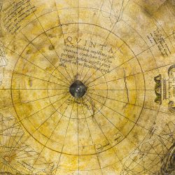
-
Mercator’s Quinta
-
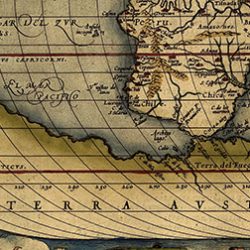
-
Ortelius’ Terra Australis
-
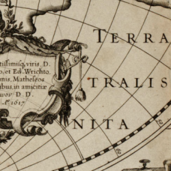
-
Hondius’ Terra Australis
In his treatise De mundi creatione ac fabrica Liber, Mercator strove to prove the existence of a fifth continent that he called Quinta. For him and other scholars of the time, this landmass was necessary to counterbalance the weight of Europe, Africa and Asia, mainly situated in the northern hemisphere. For the world to be in kilter, Quinta had to be as large as all its antagonists put together. Mercator thus represented the fifth continent as stretching around the entire globe with a very uneven coastline.
With no maritime discoveries to guide him, we can see that Mercator committed the same error as other geographers of his period by believing in the existence of a wondrous southern land as vast as the Old World. This was represented with a host of variations by 16th-century cartographers, in all shapes and sizes depending on their beliefs and on interpretations of the voyages of Magellan, Marco Polo and others.
We can hardly criticise Mercator for depicting in 1541 imaginary lands which, according to Jocodus Hondius, were still totally unknown in 1617.
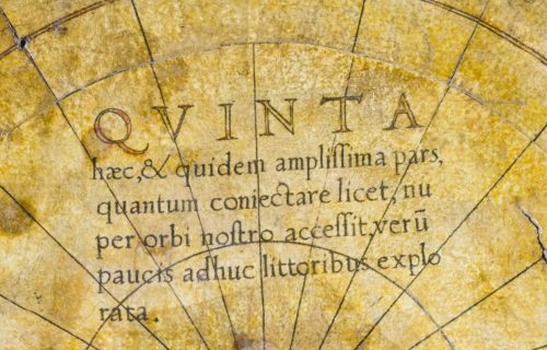 QUINTA haec, et quidem amplissima pars, quantum conjectare licet, nuper orbi nostro accessit verum paucis adhuc littoribus explorata. |
This Fifth Part, assuredly the largest to the extent that it can be conjectured, was recently added to our world. So far, however, little of its coastline has been explored |
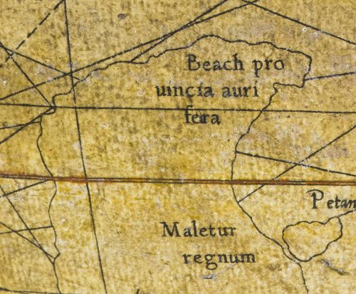 Beach provincia aurifera |
Beach, the gold province
Below the island of Java Major, the gold province of Beach covers a large peninsula extending up to the 16th latitude south. |
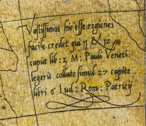 Vastissimas hic esse regiones facile credet qui 11 et 12 caput lib. 3 M. Pauli Veneti legerit collato simul 27 capite libri 6 Lud. Rom. Patricii |
Anyone who has read chapters 11 and 12 of book 3 by Paulus Venetus and compared them with chapter 27, book 6 by Lud. Rom. Patricius, will easily believe in the vastness of these regions.
Mercator refers here to the cartographer Paulus Venetus (1369-1429), whom he mentioned a number of times on his globe, and to the Italian traveller Ludovico de Verthema (c. 1470-1517). The latter’s account of his journeys in Arab lands was very popular. It was included in Novus Orbis regionum ac insularum veteribus incognitarum, a famous collection of texts on exploration published in Basel in 1532. |
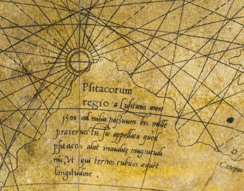 Psitacorum regio a Lusitanis anno 1500 ad milia passuum bis mille praetervectis sic appellata quod psitacos alat inauditae magnitudinis, ut qui ternos cubitos aequent longitudine |
The Land of the Parrots was so called by the Portuguese sailors who skirted between 1000 and 2000 podes of its coastline in 1500 because of the unbelievably large parrots – three cubits long – that nested there.
The Land of the Parrots, placed below Cape of Good Hope, actually seems to refer to an alleged discovery by the Portuguese mariner Pedro Alvares Cabral (c. 1467-1520), who saw such birds when he landed on the coast of Brazil in 1500. His observation was later misinterpreted. |


